Griffdowg
New Member
- Posts
- 7,194
- Location
- Somewhere in Bristol
Eve guys,
Thought I would let you all know my upcoming itinery .
.
(Expedition because it has a purpose )
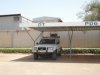
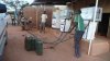
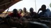
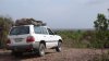
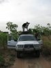
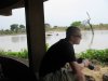
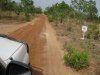
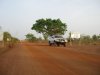
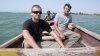
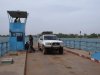
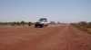
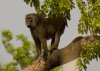
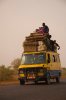
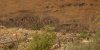
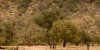
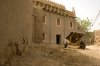
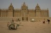
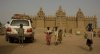
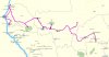
In just over 2 weeks time I will be flying out to Ouagadougou in Burkina Faso to pick up a Land... Cruiser and driving through all the national parks and protected areas into Mali, Senegal and the Gambia.
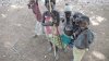
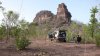
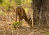
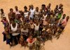
We are out there to help MAPA (MAPA Project) tracklog all the routes in, around and out of these parks and protected areas as well as logging important waypoints along the way (like fuel, banks, food, accomodation, river crossings, boundaries etc). They are working in conjunction with Tracks 4 Africa (T4A) to produce digital mapping for conservation and overland traveller purposes. If you have Google Earth it is worth downloading their overlay as they outline the national parks, protected areas, RAMSAR sites etc and give info on wildlife, park details etc.
They have all ready completed east and South Africa, now its time for West Africa. This is by far the most difficult region for many reasons, but mostly due to the fact that little information is known about the status of the protected areas and their condition on the ground. Our job is to explore, map, geotag and report this.
we have 5 weeks to do these countries while the other team heads south through Guinea, Sierra Leone and Liberia. I will post up some pics and a little report on my return as ever, my website will have more info.
see you all in a few weeks!
G
Thought I would let you all know my upcoming itinery
.(Expedition because it has a purpose
)In just over 2 weeks time I will be flying out to Ouagadougou in Burkina Faso to pick up a Land... Cruiser and driving through all the national parks and protected areas into Mali, Senegal and the Gambia.
We are out there to help MAPA (MAPA Project) tracklog all the routes in, around and out of these parks and protected areas as well as logging important waypoints along the way (like fuel, banks, food, accomodation, river crossings, boundaries etc). They are working in conjunction with Tracks 4 Africa (T4A) to produce digital mapping for conservation and overland traveller purposes. If you have Google Earth it is worth downloading their overlay as they outline the national parks, protected areas, RAMSAR sites etc and give info on wildlife, park details etc.
They have all ready completed east and South Africa, now its time for West Africa. This is by far the most difficult region for many reasons, but mostly due to the fact that little information is known about the status of the protected areas and their condition on the ground. Our job is to explore, map, geotag and report this.
we have 5 weeks to do these countries while the other team heads south through Guinea, Sierra Leone and Liberia. I will post up some pics and a little report on my return as ever, my website will have more info.
see you all in a few weeks!
G
![Hotel Delwende balcony view[1].JPG](/data/attachments/20/20252-677b9a89f9542dd3a1d83c4e10678fad.jpg)